The Hurricane Threat We Face from Climate Change

By:
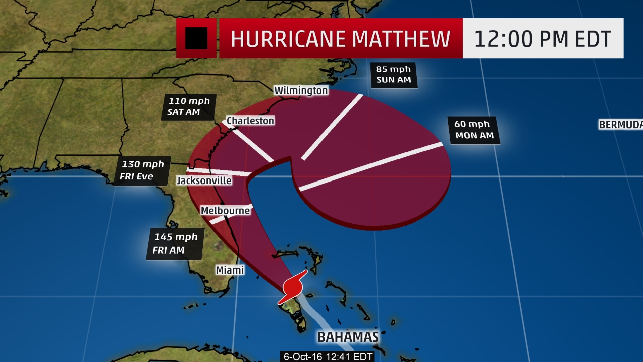
Hurricane Matthew strengthened to a Category 4 storm — with sustained winds of about 140 miles per hour — on Thursday morning, a day before its expected to make landfall in Florida on early Friday morning, meteorologists said. The largest storm to strike the U.S. in ten years has prompted governors to declare state of emergencies in four states (Florida, Georgia, North Carolina, and South Carolina) and issue evacuation orders for more than two million Americans.
 The Weather Channel - weather.com
After killing more than 100 people in Haiti and surrounding countries earlier this week, Hurricane Matthew at first weakened before regaining its strength on Thursday, Reuters reported. One radar image of the storm as it slammed Haiti — which was tweeted out by the Weather Channel's senior meteorologist Stu Ostro on Tuesday — caught the internet's attention for its ominous resemblance to a skull.
But the really scary thing is that experts say these intense storms are certain to happen in greater force in years to come as the Earth and its oceans warm due to climate change.
There are several unusual facts about Hurricane Matthew: It's the first hurricane to last this many days in October since 1963, according to meteorologist Philip Klotzbach; it's "generated the most accumulated cyclone energy" of any hurricane in this part of the Atlantic in history, ThinkProgress reported; and its striking the U.S. in October, when tropical storms are generally weaker and less common in the Atlantic.
It's unusual, but not entirely unexpected. After all, global warming has contributed to rising sea levels and warmer oceanic temperatures — conditions that can intensify tropical cyclones and extend hurricane season. While research indicates that the frequency of tropical cyclones is unlikely to change as temperatures and sea levels rise, the storms that do emerge are likely to be more powerful, with experts projecting a five percent increase in the "lifetime maximum intensity of Atlantic hurricanes," according to the National Oceanic and Atmospheric Administration.
"The nearly unprecedented rapid intensification we saw with this storm is favored by warmer oceans and greater ocean heat content," climate scientist Michael Mann told The Huffington Post. "[Scientists are] fairly certain that, whether we see more or fewer tropical cyclones, we will see more intense hurricanes and super-typhoons, like Katrina, and Sandy and Haiyan and Patricia and now Matthew."
Updated 10/6/2016 10:48 a.m. PDT: Updated to reflect the new expected landfall time.
